


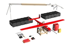


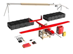
Geoscan Gemini M is an unmanned aerial system designed to perform multispectral imaging for agriculture, forestry, geological exploration, ecology, equipped with a multispectral camera of its own development Geoscan Pollux, which shoots in five ranges: visible (R, G, B), far red and near infrared. This allows to create both orthophotomaps in natural colours and vegetation index maps (SAVI, NDVI, NDRE, LAI, etc.) based on the materials of one flight.
And high-precision GNSS-receiver and global shutter provide high accuracy of photogrammetric model.


Tell us what you need and get quotes from verified suppliers