


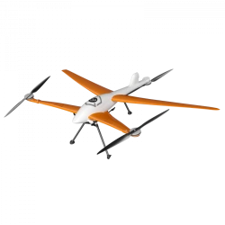
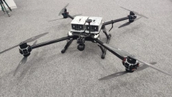
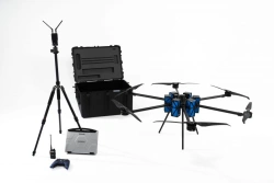
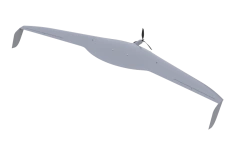
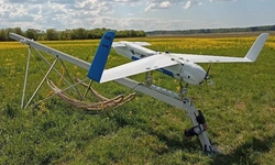
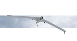
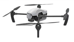
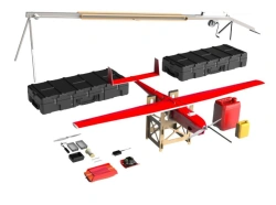
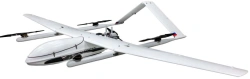
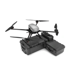
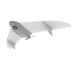
Gargoyle Unmanned Aerial System for Video Monitoring and Aerial Photography
US$1,500-4,800
Flight time:
42
System of image transmission to the console:
Digital, HD (1280 x 720)
FUTURE LABORATORY LLC 🇷🇺
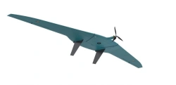
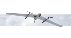
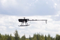
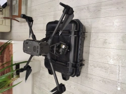
Multifunctional Drone System "Muravey
US$9,000-36,000
Flight time without load:
30
Type of product according to PP RF 616:
Helicopters and airplanes
FUTURE LABORATORY LLC 🇷🇺
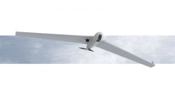
Multifunctional Drone "Muravey 24
US$9,000-30,000
Maximum range:
7
Hanging time:
38
FUTURE LABORATORY LLC 🇷🇺
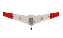
Multi-functional Drone "Mukhа" - UAV for Versatile Tasks
US$9,000-30,000
Maximum flight speed:
22
Type of product according to PP RF 616:
Helicopters and airplanes
FUTURE LABORATORY LLC 🇷🇺
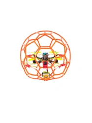
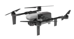
Multifunctional Unmanned Aerial System "Shmel
US$1,500-6,000
Weight with battery:
3.8
Maximum takeoff weight:
4.8
FUTURE LABORATORY LLC 🇷🇺
Industrial Drone Platform "Pegas" uDrone
US$15,000-48,000
Flight range:
60
Flight time:
75
AERODIN LLC 🇷🇺
Phoenix-3 Unmanned Aerial Vehicle Complex
US$9,000-30,000
Maximum empty flight time:
80
Dimensions of the copter in transport condition:
850 x 250 x 250 mm
BG-OPTICS LLC 🇷🇺
ERA-12 Drone Aviation System
US$90,000-300,000
Flight range:
150
Airspeed:
120
TRANSPORT OF THE FUTURE LLC 🇷🇺
Buran 10 UAV Drone with Vertical Takeoff and Landing Capability
US$90,000-300,000
Maximum flight range:
600
As part of the BAS - 4 BVS:
BVS "Reconnaissance" - 1pc; BVS "Delivery" - 3pc.
AEROKOM LLC 🇷🇺
Aerial Photography and Monitoring Drone "Albatross M5 Agro
US$9,000-30,000
Wingspan:
3300
Flight time:
270
ALBATROS LLC 🇷🇺
Albatross M5 Drone Complex for Aerial Photography and Monitoring
US$9,000-36,000
Flight time:
270
Maximum total length of the route:
300
ALBATROS LLC 🇷🇺
DIAM 20K Unmanned Aerial System (UAS)
US$9,000-30,000
Maximum payload weight:
5
Flight duration with payload of 1.5 kg:
11
DIAM-AERO LLC 🇷🇺
Unmanned Aerial System DIAM 12
US$9,000-30,000
Wingspan:
3030
Maximum flight range:
250
DIAM-AERO LLC 🇷🇺
Drone Aviation System DIAM 20
US$15,000-48,000
Wingspan:
4000
Maximum flight range:
1000
DIAM-AERO LLC 🇷🇺
Horizon 3 VTOL Aircraft Monitoring System
US$42,000-150,000
Payload:
10
Wingspan:
3700
GORIZONT-AERO LLC 🇷🇺
ZALA 421-10T Tactical UAV System for Aerial Surveillance
US$9,000-36,000
Wingspan:
1.1
Maximum takeoff weight:
4.5
CST LLC 🇷🇺
ZALA 421-16TM Drone Aviation Complex for Aerial Surveying
US$9,000-36,000
Wingspan:
1.81
Maximum takeoff weight:
6.5
CST LLC 🇷🇺
ZALA 421-16T2 Medium Range UAV Aviation Complex
US$90,000-300,000
Wingspan:
2.8
Maximum takeoff weight:
7.5
CST LLC 🇷🇺
ZALA 421-16TV Medium-Range Drone Complex for Aerial Surveying
US$9,000-36,000
Wingspan:
2.815
Maximum takeoff weight:
10.5
CST LLC 🇷🇺
Long-Range UAV System ZALA 421-16T
US$48,000-180,000
Wingspan:
2.8
Maximum takeoff weight:
10.5
CST LLC 🇷🇺

Geoscan 401 Drone System with Vertical Takeoff and Landing
US$24,000-72,000
Max. flight duration:
60
Max. shooting area per 1 flight:
3.9
GEOSCAN LLC 🇷🇺
Geoscan 801 Unmanned Aerial System (UAS)
US$15,000-42,000
Maximum flight altitude:
4000
Maximum flight duration:
40
GEOSCAN LLC 🇷🇺
Geoscan Gemini UAV System - Vertical Takeoff and Landing
US$9,000-24,000
Max. flight duration:
40
Max. flight altitude above ground level:
500
GEOSCAN LLC 🇷🇺
Geoscan Gemini M Drone - Multispectral Aerial System
US$15,000-42,000
Max. flight duration:
40
Max. flight altitude (above sea level):
4000
GEOSCAN LLC 🇷🇺
Geoscan 701 V Drone System for Real-Time Monitoring
US$15,000-48,000
Maximum flight duration:
10
Maximum flight altitude:
4500
GEOSCAN LLC 🇷🇺

Geoscan 201 Drone Aviation System
US$15,000-42,000
Max. flight duration:
180
Max. route length:
210
GEOSCAN LLC 🇷🇺
Geoscan 201T Unmanned Aerial System
US$15,000-48,000
Max. flight altitude:
4000
Max. flight duration:
180
GEOSCAN LLC 🇷🇺
Geoscan 701 Unmanned Aerial System for Aerial Photography
US$42,000-120,000
Maximum flight duration:
10
Maximum route length:
1000
GEOSCAN LLC 🇷🇺
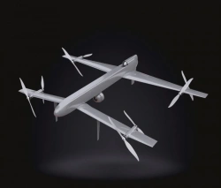
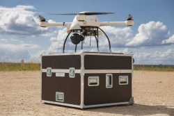
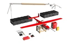
Aerial Drone System for Large Area Monitoring - VT-30E
US$90,000-300,000
Type:
Maximum takeoff weight: 30kg. Maximum target payload hardware mass: 7kg. Maximum flight duration: 1.5 hours. Maximum flight range: 40 km (with return to take-off point). Cruising instrument speed: 55 km/h. Practical n
Maximum dimensions of the load to be carried (if applicable):
Typical dimensions: 300 x 200 x 150 mm. Maximum values of parameters (L, W, H) depend on the configuration, shape and weight of the load. To be agreed with the manufacturer of the BAS
RADAR MMS OJSC 🇷🇺
Electric Vertical Takeoff and Landing Drone System Legioner E29
US$90,000-300,000
Maximum route length:
200 km linear area, up to 110 km square area
Maximum takeoff weight:
29.5
Silent Wings LLC 🇷🇺
Legioner G29s Hybrid Drone System
US$150,000-480,000
Maximum flight duration:
5 hours 30 minutes
Maximum route length:
550 km linear section, up to 250 km.sq. area section
Silent Wings LLC 🇷🇺
Gryphon-81 Unmanned Aerial Vehicle System
US$9,000-30,000
Maximum flight altitude:
4000
Maximum flight speed:
15
PLAZ LLC 🇷🇺
Gryphon-41 Unmanned Aerial System (UAS)
US$15,000-60,000
Maximum flight duration:
1
Maximum flight range:
15
PLAZ LLC 🇷🇺
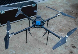
Geoscan 801 Unmanned Aerial System
US$9,000-30,000
Type of takeoff/landing:
vertically
Folded dimensions:
330mm×150mm×130mm
PLAZ LLC 🇷🇺
Aerial Photography Drone System Geoscan 701
US$36,000-96,000
Maximum flight duration:
10
Maximum route length:
1000
PLAZ LLC 🇷🇺
Gryphon-17 Unmanned Aerial Vehicle System
US$9,000-36,000
Maximum flight duration:
10
Maximum flight altitude:
4500
PLAZ LLC 🇷🇺
Gryphon-12 Unmanned Aerial System (UAS)
US$9,000-30,000
Wingspan:
2.3
Flight duration:
3
PLAZ LLC 🇷🇺
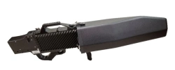
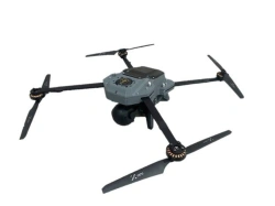
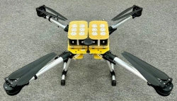
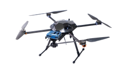
Multi-functional Helicopter-type Unmanned Aerial System JRG.A.461417.099
US$30,000-120,000
Operating range of the digital control channel in line-of-sight conditions:
9000
Weight of transported and dumped load:
1
RADIOAVIONICS OJSC 🇷🇺
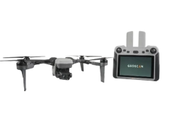
Professional Multirotor Drone System with Variable Payloads PRO
US$9,000-36,000
Maximum takeoff weight:
5
Flight duration:
40
APPLIED ROBOTICS AVIATION LLC 🇷🇺