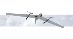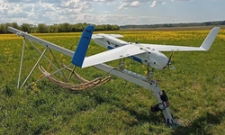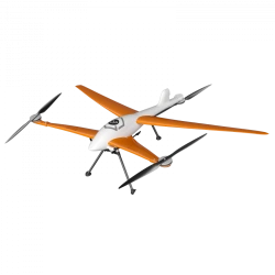


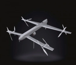
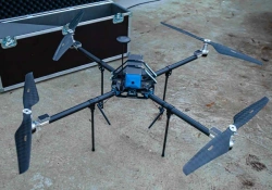
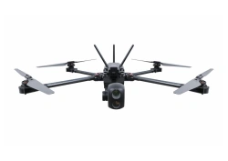
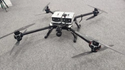
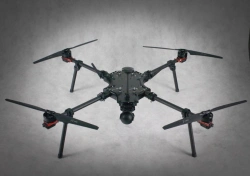
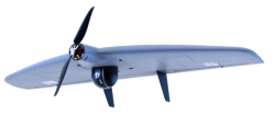
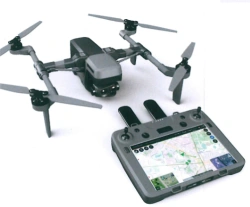
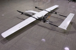
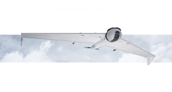
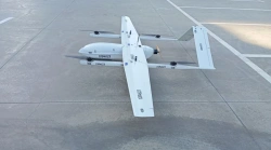
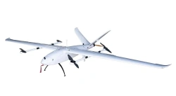
ERA-12 Drone Aviation System
US$90,000-300,000
Flight range:
150
Airspeed:
120
TRANSPORT OF THE FUTURE LLC 🇷🇺
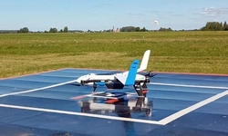
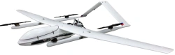
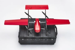
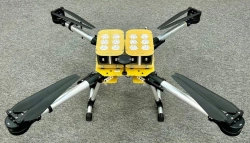
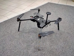
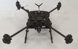
DIAM 20K Unmanned Aerial System (UAS)
US$9,000-30,000
Maximum payload weight:
5
Flight duration with payload of 1.5 kg:
11
DIAM-AERO LLC 🇷🇺
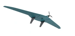
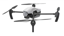
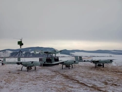
Siberia-2 Unmanned Aerial System (UAS)
US$15,000-48,000
Flight range:
10
Payload weight, not more:
4
EVR LLC 🇷🇺
Gargoyle Unmanned Aerial System for Video Monitoring and Aerial Photography
US$1,500-4,800
Flight time:
42
System of image transmission to the console:
Digital, HD (1280 x 720)
FUTURE LABORATORY LLC 🇷🇺
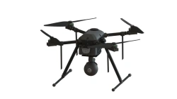
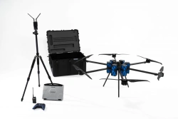
Phoenix-3 Unmanned Aerial Vehicle Complex
US$9,000-30,000
Maximum empty flight time:
80
Dimensions of the copter in transport condition:
850 x 250 x 250 mm
BG-OPTICS LLC 🇷🇺
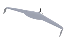
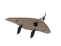
Aerial Photography and Monitoring Drone "Albatross M5 Agro
US$9,000-30,000
Wingspan:
3300
Flight time:
270
ALBATROS LLC 🇷🇺
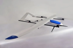
Horizon 3 VTOL Aircraft Monitoring System
US$42,000-150,000
Payload:
10
Wingspan:
3700
GORIZONT-AERO LLC 🇷🇺
ZALA 421-10T Tactical UAV System for Aerial Surveillance
US$9,000-36,000
Wingspan:
1.1
Maximum takeoff weight:
4.5
CST LLC 🇷🇺

OMEGA Unmanned Aerial System - Multirotor Drone
US$1,500-4,800
Maximum flight duration:
45
Type of product according to PP RF 616:
Helicopters and airplanes
AVAKS-GEOSERVICE LLC 🇷🇺
Unmanned Aerial Complex with Drones X4
US$9,000-30,000
Flight range:
5
Maximum allowable wind speed:
8
DRONE SYSTEMS LLC 🇷🇺

Geoscan 401 Drone System with Vertical Takeoff and Landing
US$24,000-72,000
Max. flight duration:
60
Max. shooting area per 1 flight:
3.9
GEOSCAN LLC 🇷🇺
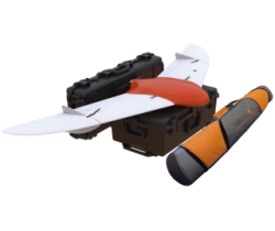
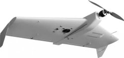
Vertical Takeoff and Landing UAV System "IKS 7" (Fixar 007)
US$9,000-30,000
Maximum flight altitude:
5000
Maximum flight duration in "aeroplane" mode at vertical take-off and landing:
60
IKS LLC 🇷🇺
Post your Buy Requirement
Get Quotes from Verified Suppliers
Save Your Time
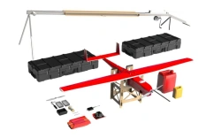
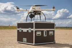
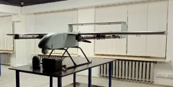
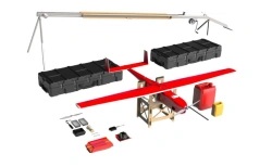
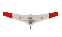
Automated Aviation System for Drones "Dandelion-3
US$9,000-36,000
Autonomy of flight in basic configuration:
40
Radius of flight:
10000
ATRI OJSC 🇷🇺
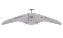
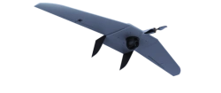
Remote Aerial Surveillance Complex with Tiltrotor UAV "Supercam SX200H
US$42,000-150,000
Flight range:
500
Maximum speed:
120
DRONE SYSTEMS LLC 🇷🇺
Multifunctional Drone System "Muravey
US$9,000-36,000
Flight time without load:
30
Type of product according to PP RF 616:
Helicopters and airplanes
FUTURE LABORATORY LLC 🇷🇺
Multifunctional Drone "Muravey 24
US$9,000-30,000
Maximum range:
7
Hanging time:
38
FUTURE LABORATORY LLC 🇷🇺
Geoscan 801 Unmanned Aerial System (UAS)
US$15,000-42,000
Maximum flight altitude:
4000
Maximum flight duration:
40
GEOSCAN LLC 🇷🇺
Remote Aerial Surveillance System with Drones "Supercam X6M2
US$9,000-30,000
Max. flight range:
10
Flight time:
55
DRONE SYSTEMS LLC 🇷🇺
Multi-functional Drone "Mukhа" - UAV for Versatile Tasks
US$9,000-30,000
Maximum flight speed:
22
Type of product according to PP RF 616:
Helicopters and airplanes
FUTURE LABORATORY LLC 🇷🇺
Multifunctional Unmanned Aerial System "Shmel
US$1,500-6,000
Weight with battery:
3.8
Maximum takeoff weight:
4.8
FUTURE LABORATORY LLC 🇷🇺
Geoscan Gemini UAV System - Vertical Takeoff and Landing
US$9,000-24,000
Max. flight duration:
40
Max. flight altitude above ground level:
500
GEOSCAN LLC 🇷🇺
Industrial Drone Platform "Pegas" uDrone
US$15,000-48,000
Flight range:
60
Flight time:
75
AERODIN LLC 🇷🇺
Supercam S100 Unmanned Aerial Vehicle Complex
US$9,000-30,000
Flight time:
80
Max. takeoff weight:
3.5
DRONE SYSTEMS LLC 🇷🇺
Rubin A50 Unmanned Aerial System (UAS)
US$90,000-300,000
Flight time:
B1/B8 2100/900 MHz
Type of power plant:
Electrical
TS INTEGRATION LLC 🇷🇺
Basic Rubin A50 Unmanned Aerial System
US$27,000-72,000
Flight time:
B1/B8 2100/900 MHz
Type of power plant:
Electrical
TS INTEGRATION LLC 🇷🇺
Geoscan Gemini M Drone - Multispectral Aerial System
US$15,000-42,000
Max. flight duration:
40
Max. flight altitude (above sea level):
4000
GEOSCAN LLC 🇷🇺
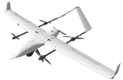
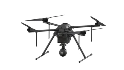
Gryphon-81 Unmanned Aerial Vehicle System
US$9,000-30,000
Maximum flight altitude:
4000
Maximum flight speed:
15
PLAZ LLC 🇷🇺

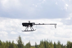
LUN-20 Unmanned Aerial System (UAS) ACI 791488 025
US$90,000-360,000
Maximum flight duration of the BVS:
At least 10 hours
Maximum radius of action of BVS (with the possibility of application of central heating centre) in automatic or semi-automatic m:
At least 120 kilometres from NAPS
STC LLC 🇷🇺
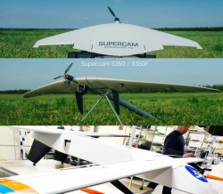
Remote Aerial Surveillance Drone System "Supercam S150
US$9,000-30,000
Max. flight range:
110
Flight time:
2
DRONE SYSTEMS LLC 🇷🇺
Remote Aerial Surveillance Drone System "Supercam S350F
US$9,000-36,000
Max. flight range:
240
Flight time:
4.5
DRONE SYSTEMS LLC 🇷🇺
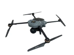
Gryphon-41 Unmanned Aerial System (UAS)
US$15,000-60,000
Maximum flight duration:
1
Maximum flight range:
15
PLAZ LLC 🇷🇺
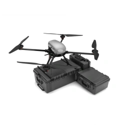
Airbug Drone System for Terrain Monitoring and Transport
US$30,000-120,000
Type of product according to PP RF 616:
Helicopters and airplanes
Type of product according to PP RF 616:
Helicopters and airplanes
AIRBURG OJSC 🇷🇺
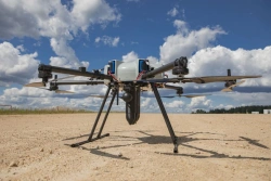
Sigma Unmanned Aerial System (UAS)
US$30,000-120,000
Maximum takeoff weight:
30
Payload weight:
5
AVAKS-GEOSERVICE LLC 🇷🇺
Remote Aerial Surveillance Complex with Drones "Supercam S250
US$9,000-36,000
Max. flight range:
180
Flight time:
3
DRONE SYSTEMS LLC 🇷🇺
Vertical Takeoff and Landing Unmanned Aerial System "B20
US$18,000-60,000
Maximum takeoff weight:
60
Payload:
15
Berkut LLC 🇷🇺
Advanced Unmanned Aerial System for Remote Surveillance (UAS STKT)
US$9,000-36,000
Supercam S150 flying time:
1.5
Summer time of Supercam S350:
4
DRONE SYSTEMS LLC 🇷🇺
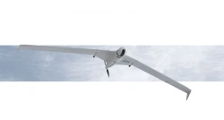
ZALA 421-16TM Drone Aviation Complex for Aerial Surveying
US$9,000-36,000
Wingspan:
1.81
Maximum takeoff weight:
6.5
CST LLC 🇷🇺
Geoscan 801 Unmanned Aerial System
US$9,000-30,000
Type of takeoff/landing:
vertically
Folded dimensions:
330mm×150mm×130mm
PLAZ LLC 🇷🇺
ZALA 421-16T2 Medium Range UAV Aviation Complex
US$90,000-300,000
Wingspan:
2.8
Maximum takeoff weight:
7.5
CST LLC 🇷🇺
Supercam S350 Unmanned Aerial Complex for Remote Area Surveillance
US$15,000-48,000
Max. flight range:
240
Flight time:
4.5
DRONE SYSTEMS LLC 🇷🇺
Electric Vertical Takeoff and Landing Drone System Legioner E29
US$90,000-300,000
Maximum route length:
200 km linear area, up to 110 km square area
Maximum takeoff weight:
29.5
Silent Wings LLC 🇷🇺
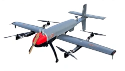
Buran 10 UAV Drone with Vertical Takeoff and Landing Capability
US$90,000-300,000
Maximum flight range:
600
As part of the BAS - 4 BVS:
BVS "Reconnaissance" - 1pc; BVS "Delivery" - 3pc.
AEROKOM LLC 🇷🇺
Aerial Photography Drone System Geoscan 701
US$36,000-96,000
Maximum flight duration:
10
Maximum route length:
1000
PLAZ LLC 🇷🇺
Unmanned Aerial System DIAM 12
US$9,000-30,000
Wingspan:
3030
Maximum flight range:
250
DIAM-AERO LLC 🇷🇺
Unmanned Aerial Vehicle System OG-25
US$42,000-150,000
Maximum payload:
10
Maximum flight altitude:
4000
BAS GLORY AIR LLC 🇷🇺