Products — UAV & Drones
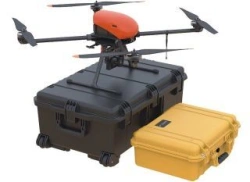
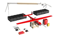
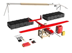
Geoscan 401 Geophysics Drone System
US$90,000-300,000
Max. flight distance:
30
Max. flight altitude (above ground level):
500
GEOSCAN LLC 🇷🇺
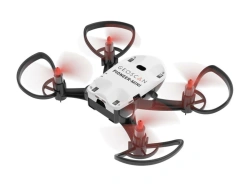
Multifunctional Educational Drone for Schools - Geoscan Pioneer Mini
US$90-300
Size of copter:
175 x 140 x 38 mm
Maximum flight speed:
20
GEOSCAN LLC 🇷🇺

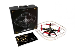
Geoscan Pioneer FPV Drone Assembly Kit
US$360-960
Airspeed:
100
Overall dimensions:
180x180x75 mm
GEOSCAN LLC 🇷🇺
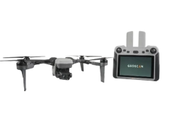
GeoScan Pioneer Assembly Kit for Drones
US$90-300
Maximum flight speed:
65
Overall dimensions:
290x290x120
GEOSCAN LLC 🇷🇺

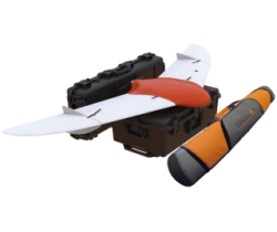
Geoscan 401 Drone System with Vertical Takeoff and Landing
US$24,000-72,000
Max. flight duration:
60
Max. shooting area per 1 flight:
3.9
GEOSCAN LLC 🇷🇺
Geoscan 801 Unmanned Aerial System (UAS)
US$15,000-42,000
Maximum flight altitude:
4000
Maximum flight duration:
40
GEOSCAN LLC 🇷🇺
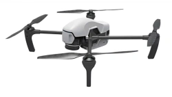
Geoscan Gemini UAV System - Vertical Takeoff and Landing
US$9,000-24,000
Max. flight duration:
40
Max. flight altitude above ground level:
500
GEOSCAN LLC 🇷🇺
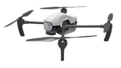
Geoscan Gemini M Drone - Multispectral Aerial System
US$15,000-42,000
Max. flight duration:
40
Max. flight altitude (above sea level):
4000
GEOSCAN LLC 🇷🇺
Geoscan 701 V Drone System for Real-Time Monitoring
US$15,000-48,000
Maximum flight duration:
10
Maximum flight altitude:
4500
GEOSCAN LLC 🇷🇺

Geoscan 201 Drone Aviation System
US$15,000-42,000
Max. flight duration:
180
Max. route length:
210
GEOSCAN LLC 🇷🇺
Geoscan 201T Unmanned Aerial System
US$15,000-48,000
Max. flight altitude:
4000
Max. flight duration:
180
GEOSCAN LLC 🇷🇺
Geoscan 701 Unmanned Aerial System for Aerial Photography
US$42,000-120,000
Maximum flight duration:
10
Maximum route length:
1000
GEOSCAN LLC 🇷🇺