


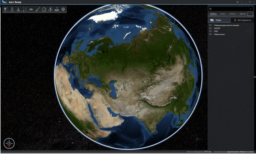
The software complex provides operative solution of tasks on visualisation of various types of geospatial information, presented in the unified tile format in planned and three-dimensional mode without connection to the Internet, definition of spatial coordinates of any point, and also carrying out of calculations on the ground, with and without taking into account relief.
Provides search by coordinates and names, calculation of visibility from a point and export of raster data to a file for printing, or for use in third-party software..


Tell us what you need and get quotes from verified suppliers